News - United States of America


Educators and Students Weather the Storm in Support of NASA's IMPACTS Mission
This January and February, educators and their students from 11 sites in five states and one Canadian province collected measurements of snow (or rainfall) accumulations. They were participating in Mission SnowGLOBE, a GLOBE intensive observation period in support of the NASA IMPACTS mission. IMPACTS (Investigation of Microphysics and Precipitation for Atlantic Coast-Threatening Snowstorms) was a three-year mission to study the processes that produce snowbands; 2023 was the last year of data collection.
IMPACTS, in a nutshell, consisted of two aircraft flying simultaneously during snowstorms, following the same flight path but separated by several thousand feet of altitude. The P-3 aircraft typically flew within the snowstorm clouds; the ER-2 aircraft flew at high altitudes above the storms. Each aircraft was fitted with multiple sensors, cameras, radar, and other instruments to collect a variety of data. While the ER-2 aircraft was a one-person operation, the P-3 aircraft required a large crew to monitor all the instruments and incoming data. Often, the flights were accompanied by crews on the ground from partnering universities. Each flight lasted approximately eight hours.
“Mission SnowGLOBE offered an opportunity for students to look at snow from a new perspective through the lens of a scientist. They knew the information was being collected for a specific purpose and were enthusiastic to be part of the process.” (Amanda Blunda, Buxton Center Elementary School, Maine)
IMPACTS announced science flights to monitor snowstorms about 48 hours before expected takeoff. When the GLOBE U.S. Coordination Office received notice of a potential flight, they sent messages to educators to alert them of the flight period. Ideally, educators and students would collect their measurements during the flight times, but they were encouraged to collect before and after the flights as well. Occasionally, schools were unable to collect during the flights due to timing, for instance when flights occurred on weekends.
“I liked that MissionSnow GLOBE reached out to let us know when data was to be collected. It made it exciting for the students to be able to collect data along with Mission SnowGLOBE.” (Kathryn Bohner, Cloverleaf Local Schools, Ohio)
Some of the school sites involved were unable to collect any actual snow data, but not from lack of trying. Instead, they collected weather and rainfall measurements throughout the mission. Whatever measurements they were able to collect were uploaded to the GLOBE database.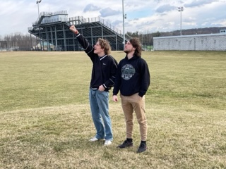
“I really liked the real-world data collection being done by students and the ability to see their data in an international database. I think a lot of my students were insecure about collecting data for a valuable mission, but realized they had the tools needed to obtain accurate and meaningful data and to do real science.” (Tiffany Leone, Margaretville Central School, New York)
Approximately 120 students from grades 3 to 12 participated, as well as some university students and GLOBE Partners. Their sites were spread across the Northeastern U.S., including Connecticut, Maine, Michigan, New Hampshire, New York, and Ohio; one site was in Ontario, Canada.
Despite the inconsistent weather, students and educators were glad to participate in the mission. When asked what he liked best about Mission SnowGLOBE, Christopher Newlan, teacher at Francis Walsh Intermediate School in Connecticut responded, “The excitement from my students that they were working with NASA!!”
Photo captions (top to bottom)
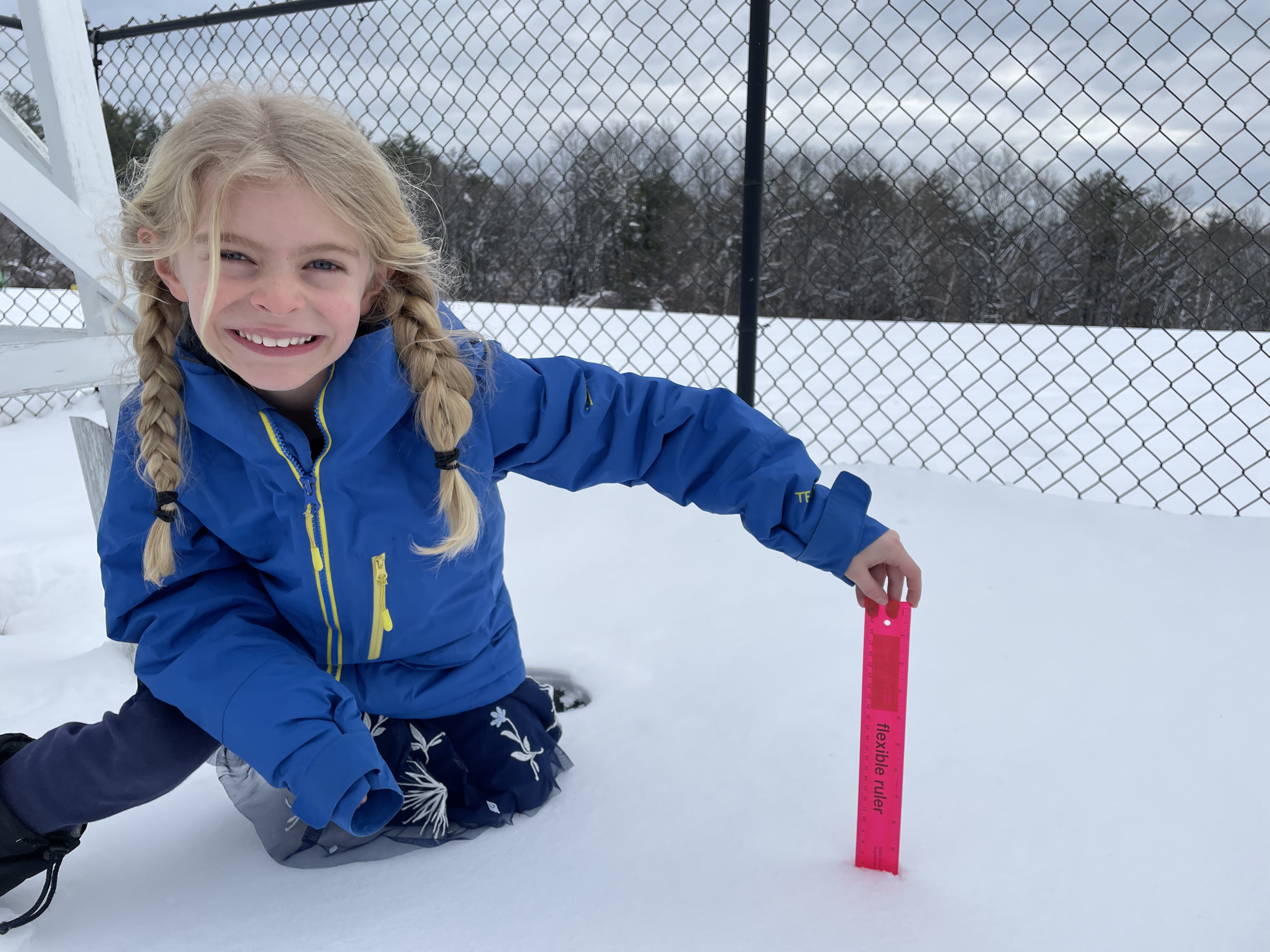
Photo 1: a young student holds a ruler in snow to measure snow depth (photo credit: Sarah Wisecarver)
Photo 2: two students stand in a field looking into the sky, one is pointing at the sky; they are collecting cloud data (photo credit: Kathryn Bohner)
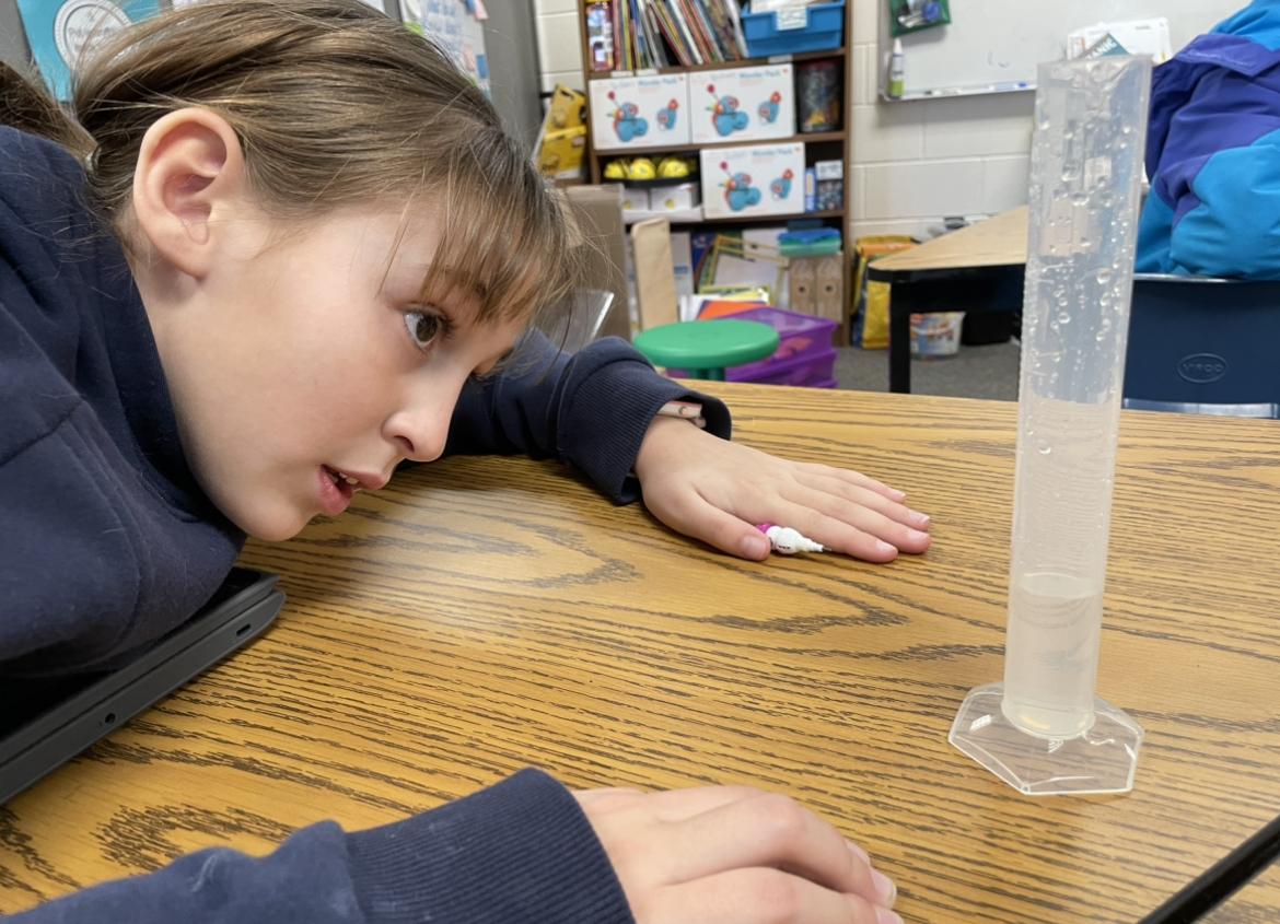
Photo 3: a student sitting a table with a graduated cylinder containing water to measure snowpack liquid equivalent (photo credit: Sarah Wisecarver)
Investigation Areas > Atmosphere: News Topics: IOPsNews origin: United States of America