DEI Task Force

Diversity, Equity, and Inclusion (DEI) Task Force

Important: The GLOBE DEI Task Force has transitioned into the GLOBE Diversity, Equity, and Inclusion Working group. For all current information related to DEI at GLOBE, check out the GLOBE DEI Working Group page.

With the support of GLOBE Program Sponsors from NASA and NSF, in the fall of 2019 the GLOBE DEI Task Force was formed with the goal of creating a GLOBE statement and implementation plan on Diversity, Equity and Inclusion. In February 2020 the group met in Boulder, Colorado for a DEI workshop, and to begin working on these statements. This group has met monthly ever since to collaboratively produce the statements shown below. These statements and action plan were presented to the GLOBE Community at the 2020 Virtual Meeting. A recording of this presentation can be found on GLOBE's Annual Meeting videos page
 

DEI Task Force Members


Shadrack Agyiri (Ghana) Jill Karsten (USA)
Jennifer Bourgeault (USA) Julie Malmberg (USA)
Katie Chapman (USA) Josette Neal-De-Stanton (USA)
Kimberly Davis (USA) David Padgett (USA)
Mindi DePaola (USA) Richard Parsons (USA)
Francis Emralino (Philippines) Marina Pavlic (Croatia)
Wrayna Fairchild (USA) Ana Prieto (Argentina)
Trena Ferrell (USA) Nate Raynor (USA)
Rosalba Giarratano (USA) Juan Felipe Restrepo Mesa (Colombia)
Kate Goss (USA) Elena Sparrow (USA)
Nikitah Imani (USA) Josephine Joy Tolentino (Philippines)

Action Plan (detailed):

  • Create DEI Working Group
  • Administer DEI Assessments
  • Build a DEI Standard Operating Procedure (SOP)
  • Develop DEI based Resources
  • Establish DEI Training Opportunities
  • Form DEI Supportive Partnerships
  • Find funding for DEI
  • Communicate DEI Initiatives

To see translations of the draft DEI Definitions, Mission, Vision and overview of the Draft Action Plan, click here.


Recent DEI-Related Blog Posts


Asset Publisher

null ESRI Ocean, Weather and Climate Forum and GLOBE

            Two weeks ago, I attended the ESRI Ocean, Weather and Climate (OWC) Forum. This Forum featured over 30 speakers across two half-days in the forms of lightning talks, keynote speakers and software demos. It was illuminating to see such a wide range of uses and projects with ESRI’s ArcGIS software within the Ocean, Weather and Climate realms. The demos shared some advanced mapping and Geographic Information System (GIS) opportunities within the ArcGIS Pro software. ArcGIS Pro is ESRI’s desktop paid application and has a wide range and depth of mapping and spatial analytics abilities. I recently gave part of a webinar on ArcGIS Online for the upcoming International Virtual Science Symposium (IVSS), which contains entry level mapping information on ESRI’s free mapping resources. Check it out here: https://youtu.be/yuwcOD5_Vdg.

           Going back to OWC, out of all the projects that were presented, none of them specifically noted working with citizen science data. All of the data referenced in the talks were either through federal, university or other non-profit institutions. This got me thinking about how GLOBE can play a larger role with mapping and GIS professionals. What can GLOBE provide in order to best work with GIS? Are more spatially diverse data sets needed? How can citizen science be an asset for certain types of GIS research? I am hoping to continue to explore this and how GLOBE can play a larger role in this community! 

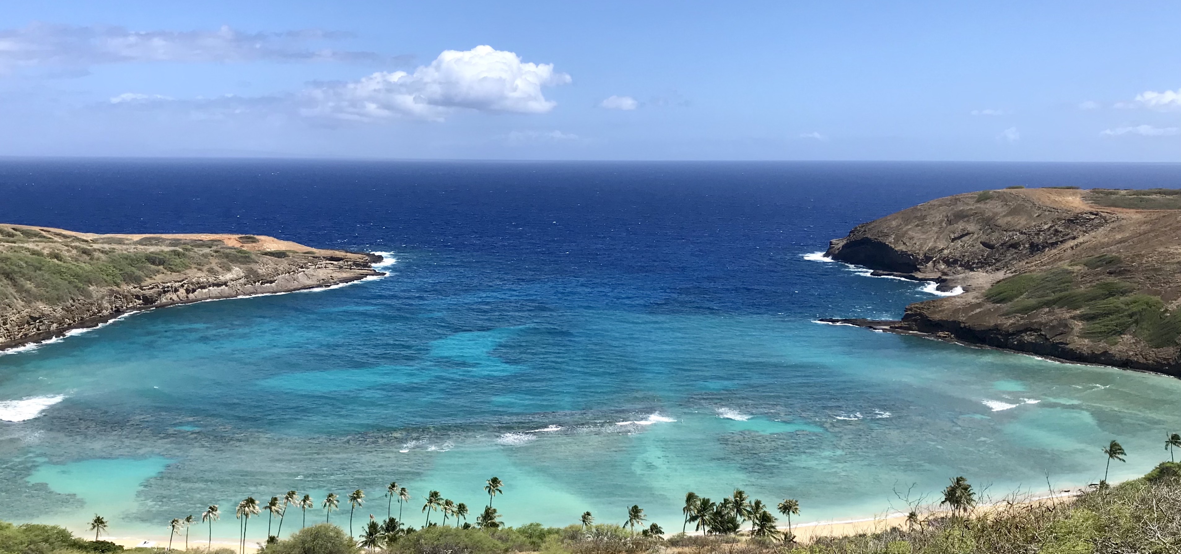
Ocean Picture

Image Description: View of Hanauma Bay towards the Pacific Ocean on O'ahu in Hawai'i

            Another noteworthy point from OWC was that it was heavily weighted towards ocean sciences. Thinking generally, since humans can’t see everything in the ocean, many ocean scientists rely on mapping to get a fuller picture of that sphere. This is an area of science that GLOBE has limited reach on. In order to interact more with GIS professionals, GLOBE may need to expand some of its data collection from the ocean. I know this would not be possible for all GLOBE members (e.g. people who live inland) and there are likely limits on how far out into the ocean GLOBE members could get data. A great opportunity for this is GLOBE members could connect with ocean scientists in their community (e.g. through GISN https://www.globe.gov/web/globe-international-stem-network/overview/gisn-members) to work together to create collaborations! With that said, this is just my brainstorming and I would be interested to learn more about the needs of scientists in respect to citizen science data. I’m excited to continue to explore this more and hopefully connect GLOBE data with more ESRI mapping professionals.

            I would also like to add, My NASA Data has some very cool resources that connect GLOBE data with ESRI’s Story Maps software which can be found here: https://mynasadata.larc.nasa.gov/basic-page/story-map-collections. If you have any other resources that connect GIS and GLOBE Data, or, if you have any ideas for my questions/thoughts, please add them in the comments or send them to me directly!