IOPs - Student Climate Research Campaign


Intensive Observing Periods
Intensive Observing Periods (IOPs) are focused periods of time where participants are encouraged to collect large amounts of data and enter it in the GLOBE database.
Dr. Sandy MacDonald, one of the National Oceanic & Atmospheric Administration (NOAA) Deputy Assistant Administrators, believes that the IOP campaign is critical for students and scientists alike.
Climate Scientists will lead these Intensive Observing Periods, and both students and scientists can then use the GLOBE data and long-term climate data to develop climate inquiries and conduct research. There are four activities that can be undertaken for these IOPs: the 'Great Global Investigation of Climate', 'Climate and Land Cover', 'Phenology and Climate', and 'Surface Temperature' and you can start them at any of the scheduled times, and complete as many IOPs as you like.
Schedule for Intensive Observing Periods
| Sep | Oct | Nov | Dec | Jan | Feb | Mar | Apr | May | Jun | Jul | |
|---|---|---|---|---|---|---|---|---|---|---|---|
| Climate and Land Cover | X | X | X | X | |||||||
| Great Global Investigation of Climate | X | X | X | X | |||||||
| Phenology and Climate | X | X | X | X | X | X | X | X | X | X | |
| Surface Temperature | X |
The Great Global Investigation of Climate
The Great Global Investigation of Climate (GGIC) is focused on defining local climate through GLOBE protocols and the student inquiry question "What is my climate and how has it changed?"
Teachers and students are encouraged to collect and enter temperature and precipitation data in the GLOBE database and investigate how to classify local climate using these atmospheric data. In the course of the GGIC students investigate:
-
Precipitation and temperature data that can be used to characterize climate
-
Local climate that can be classified
-
Local studies of weather that may lead to the further study of climate.
The Climate and Land Cover Project
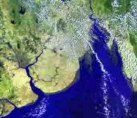
The Climate and Land Cover (CLC) investigation is a research activity involving GLOBE schools and climate scientists to understand land cover and climate.
-
Using GLOBE land cover protocols, students take photographs and classify representative land cover areas near their schools and upload the data to the GLOBE database.
-
This data set can be used by students around the world to compare land cover. In addition, the data is used by scientists worldwide to improve land cover classifications for climate models.
The Phenology and Climate Project
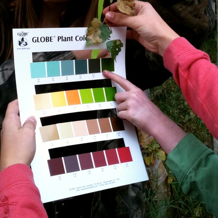
The Phenology and Climate Project is a research effort between GLOBE schools and climate scientists to improve our understanding of how climate relates to the cycles of living things (i.e. phenology).
- Using GLOBE phenology protocols, students make observations of the timing of budburst, green-up, and green-down of native plants near their school.
- Students will also use GLOBE atmosphere and soil protocols to collect climate data that can be used by students and scientists to answer key science questions about how the growing season is affected by climate.
The Surface Temperature Field Campaign
The Surface Temperature Field Campaign is a campaign to investigate the impacts of different types of surfaces on the temperaure of the Earth. The temperature of your surrounding environment is ever changing, and thermal energy is constantly being transferred among all the components of the environment. The temperature of the atmosphere will affect the temperature of Earth's surface, and likewise the temperature of Earth's surface will affect the temperature of the atmosphere.
Using the Surface Temperature protocol, students will make observations of the surface temperature of various objects and substrates within their environment.