
The month of June brings with it hurricane season in the North Atlantic Ocean basin. Both countries in GLOBE’s North America Region, Canada and the United States, are affected by these storms. It is important to remember that tropical cyclones are named differently in various locations. In the Atlantic and east of the International Date Line in the North Pacific, they’re called hurricanes. In the North Pacific west of the International Date Line, they’re typhoons; and in the Indian Ocean and South Pacific, these storms are cyclones.
Many records have been broken in the North Atlantic basin recently. For example, the 2005 season saw a total of 28 named tropical systems, easily breaking the previous record of 21 storms. Between the years of 2000 and 2012, 20 named tropical storms or hurricanes made landfall in the United States, and another 13 in Canada. The map below shows the tracks of the landfalling storms from 2000-2011, as the 2012 storm tracks have yet to be entered into NOAA’s historical hurricane track database.
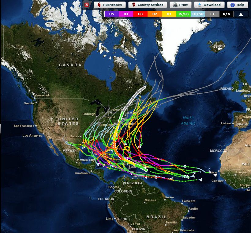
US and Canadian landfalling hurricanes from 2000-2011. Map courtesy of NOAA.
After the 2005 Atlantic hurricane season, many studies were formed to understand the National Oceanic and Atmospheric Administration’s (NOAA) ability to forecast these types of storms. The Hurricane Intensity Research Working Group was established in order to document methods for improving hurricane intensity forecasting, an area of forecasts in which little improvement had been made in many years. Based on their recommendations, the Hurricane Forecast Improvement Project was established in 2009.
Some of the goals of the project are to reduce hurricane track and intensity errors, increase the probability of detection for rapid intensification of storms (rapid intensification is defined as the dramatic decrease of sea-level pressure over a short period of time), and extend the lead time of forecasts. In order to reach these goals, scientists from the hurricane research, hurricane development and hurricane operations (also known as the forecasters) are working together to make improvements.
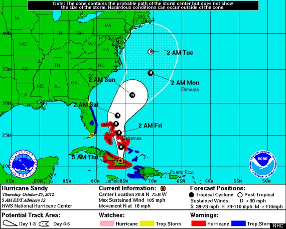
Projected path of Hurricane Sandy, the most recent U.S. landfalling hurricane. The cone indicates the probable, but not guaranteed, path that the storm could take. Photo courtesy of the National Hurricane Center
Scientists working on the project are hopeful that using new data assimilation systems and ensembles will greatly improve forecasts. Data assimilation is the process of putting real observations into a weather prediction model, and ensemble forecasts is a technique where model forecasts are combined to generate a more accurate composite forecast. Data from satellites and aircraft are also expected to have an impact on forecast improvement.
By improving hurricane forecasts, it is expected that there will be higher confidence in the forecasts so the public is more apt to respond saving lives and property. It will be interesting over the next few years to monitor this project and see how hurricane forecasts are improved.
Suggested activity: Do you live in an area prone to these types of storms and experience the weather associated with them? How could you use GLOBE protocols to understand more about them? Let us know about it by leaving a comment here or on Facebook, or sending us an email at science@globe.gov.
Data assimilation is the process of putting real observations into a weather prediction model, and ensemble forecasts is a technique where model forecasts are combined to generate a more accurate composite forecast.