
In the last blog, I looked down – at a puddle. But most of the time, I look up: to see what birds are overhead, and to watch clouds.
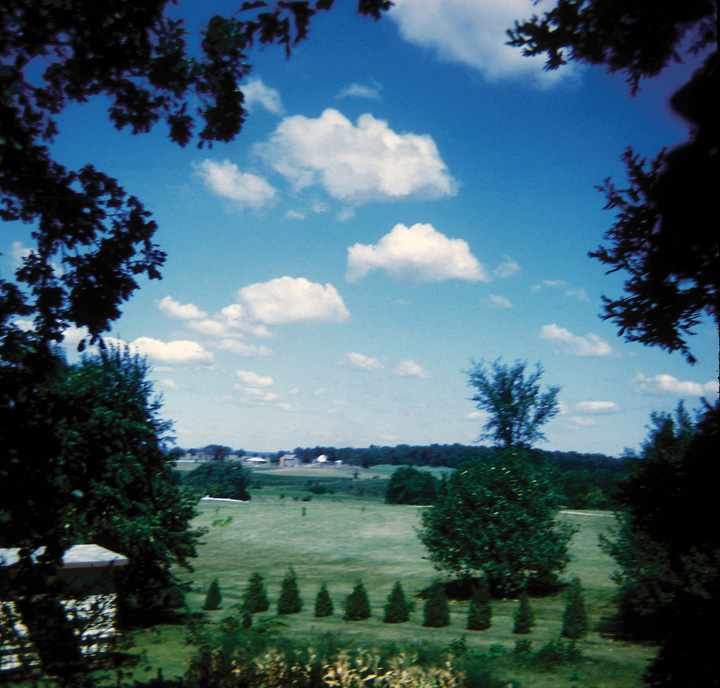
Figure 1. Picture of fair-weather cumulus clouds east of Beloit, Wisconsin, USA.
Have you ever wondered how big a cloud is? Or how much it weighs? Or how long it lasts?
I’ve often thought about these questions, and it is actually fairly simple to get some “typical” answers.
How big is a cloud? What is its height? Width? Volume?
There are a several ways to get an idea how “big” clouds are.
You can look at clouds in a satellite image of your area, and “scale” the clouds to the size of the state or country you live in. This works best for larger clouds like thunderstorm clouds, or sheets of stratocumulus or altocumulus that stretch across the sky. Some sites for accessing satellite pictures are:
- For the United States: RAP Real-Time Weather Data.
- For Australia: Bureau of Meteorology Satellite Images.
- The British Met Office has images for much of the world, for example:
- For Europe
- For Asia
- For Africa
- For South America
- For North America
When you are in an airplane or on a mountainside or tall building, you can look at the shads of the clouds on the ground. In the Midwestern United States, the land is divided into one-mile (1.6-kilometer) sections; with roads often marking the sides of the section, so that the land looks like graph paper. By comparing the size of the shadow to the mile-square sections, you can see how big the cloud is.
When you are in airplane (or a car, bus, or train), you can time how long it takes to pass through a cloud or its shadow. For the airplane, you need to know how fast it is traveling with respect to the air.
- For a jet airplane at cruising altitude, 550 miles per hour or 250 meters per second is a good first guess. So, if it takes 10 seconds to pass through a cloud, the cloud is 2.5 kilometers wide.
- For a car, you need to assume that the cloud isn’t traveling very fast, since clouds can travel as fast as cars. If you are traveling at 70 miles per hour (about 35 meters per second) beneath a cloud that is not moving, and it takes 10 seconds to go through the its shadow, the cloud is 350 meters across. If the cloud is traveling with the car, you might overestimate the cloud’s width. (If the cloud travels as fast as you are traveling in the same direction as the car, you will stay in shadow as long as the cloud exists). Things get more complicated if the cloud moves across your path. Also, late in the afternoon, cloud shadow size increases with the depth as well as the width of the cloud. But remember, we’re only trying to get a rough idea of cloud size.
How much does a cloud weigh?
I include only the water in the cloud – not the air. Think about a “typical” cumulus cloud, about a kilometer on a side.
The volume of this cumulus cloud is:
1000 meters times 1000 meters .times 1000 meters, or 1,000,000,000 cubic meters
Measurements from aircraft flying through cumulus clouds suggest a cubic meter contains about 0.5 grams of water – that’s the equivalent of a drop about 0.5 cm in diameter – about the size of small marble. Thus our “typical” cloud weighs
0.5 gram per cubic meter times 1,000,000,000 cubic meter = 500,000,000 grams or 500,000 kilograms, 1,100,000 pounds, or 550 tons.
Why doesn’t a cloud fall out of the sky, if it’s so heavy?
If the cloud were a 550-ton weight, the cloud would fall out of the sky. But a cloud is made up of tiny droplets, which fall very, very slowly. (You can check this out by dropping tiny pieces of paper and watch how slowly they fall). A cloud droplet is tiny – it’s about 100th the diameter of a typical rain drop – or one-millionth of the volume!
Cloud droplets do fall, only slowly. But something else is often happening. The air in many clouds is rising. For example, in our typical cumulus cloud, the air can be rising at a rate of several meters a second – enough not only to keep the smallest cloud droplets from falling, but even smaller raindrops might never reach the ground.
Why is the air rising? In the case of our cumulus cloud, the air is rising because it is less dense than the surrounding air. This is mostly because the air in the cloud is warmer than the surrounding air. The air, being buoyant, will rise until it encounters air warmer than it is.
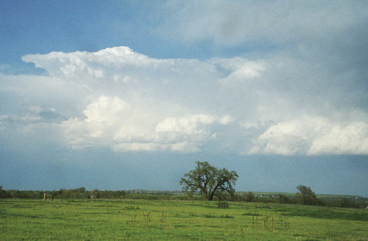
Figure 2. The air in this cumulonimbus cloud was rising, but slowed down and spread out when it was no longer buoyant.
In some clouds, though, the particles are falling. In the cloud in the photograph below, ice particles are falling.
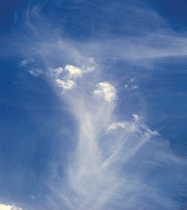
Figure 3. Ice crystal fall streaks forming cirrus clouds.
This discussion is from:
LeMone, M.A., 2008: The Stories Clouds Tell. Published by the University Corporation for Atmospheric Research. Available from the NCAR Science Store. This booklet was originally written for the American Meteorological Society for use by teachers participating in Project ATMOSPHERE.
For more about clouds, GLOBE has the following resources:
- Cloud protocol
- Cloud quiz
- Elementary GLOBE Do you know that clouds have names?
Also, you can find more at Windows to the Universe:
Go to bottom of page and you will see a link to clouds in art.
Finally, there are time-lapse cloud pictures at: