This week’s blog post comes to us from Dr. Janis Steele and Dr. Brooks McCutchen. Drs. Steele and McCutchen, along with their three sons, have been aboard Research Vessel Llyr since April 24, 2013. Read about their adventure in the Intertropical Convergence Zone here.
When people think of life in the seas, it is often the majestic that comes to mind, such aswhales, sharks, rays and coral reefs, or our own sustenance in the form of the fish that feed billions of us around the world. Rarely do we think of plankton, the tiny organisms found across the world’s oceans. Plankton are comprised of two general types: phytoplankton, which are microscopic plant-like cells, and zooplankton, the tiny animals that graze the phytoplankton (there are, however, some plankton that can reach nearly 2 m wide and weigh more than 200 kg, such as the Nemopilema nomurai, or the Nomura jellyfish) Despite their size, these small life forms are enormously important for the planet in several ways. First, they are the foundation of the marine food web as they provide 50% of the oxygen we breathe. Additionally, they play an integral role in the global carbon cycle, which you can learn more about through GLOBE’s global carbon cycle activities.
The word plankton is derived from the Greek word “planktos”, which means drifter, since plankton drift at the whim of the ocean’s currents. While they have almost limitless distribution across the world’s oceans, their vertical extent is limited to the sunlit layer of the water, known as the photic zone. Here they use sunlight to photosynthesize, converting carbon dioxide (CO2) into organic compounds and producing half the oxygen we breathe. With this action, plankton are as important as the trees and plants in making our planet habitable.
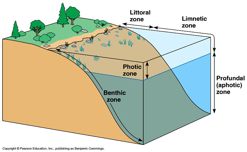
Schematic showing the photic zone. Image from Pearson Education.
In addition, by converting CO2 into organic compounds, plankton play both short term (centuries) and long term (geological time frames) roles in the global carbon cycle. When they die and sink to the ocean floor, they may be part of a long term sequestering of carbon as part of the ocean floor or become part of a carbon pump cycle that moves carbon throughout the oceans and helps manage atmospheric CO2. The oceans take in CO2 at greater levels in colder waters near the poles. Because that cold water is also denser, it sinks and transfers the carbon to the deep ocean where it can circulate. Eventually, this carbon-rich deep water returns to the surface at upwelling regions where plankton consume it as part of their biological processes and then return it back to the depths in death.
While there is still much to be learned about plankton, scientists are finding evidence that these organisms are under significant threat. Two changes are of particular concern: rising ocean temperatures and changing pH. Since plankton live at the ocean’s surface, they are particularly susceptible to temperature changes in the water and scientists have begun recording alterations in the distribution, abundance, and seasonality of plankton in both the Atlantic and Pacific Oceans. In addition, increasing atmospheric concentrations of CO2 are affecting the ocean’s pH. As carbon dioxide (CO2) enters the sea surface, it dissolves in the water (H20) and forms a weak acid called carbonic acid. As atmospheric CO2 increases, more enters the sea and scientists are documenting increasing acidity in ocean water. Many zooplankton rely on calcium carbonates in the water to help build their structures and these minerals are less available in more acidic conditions.
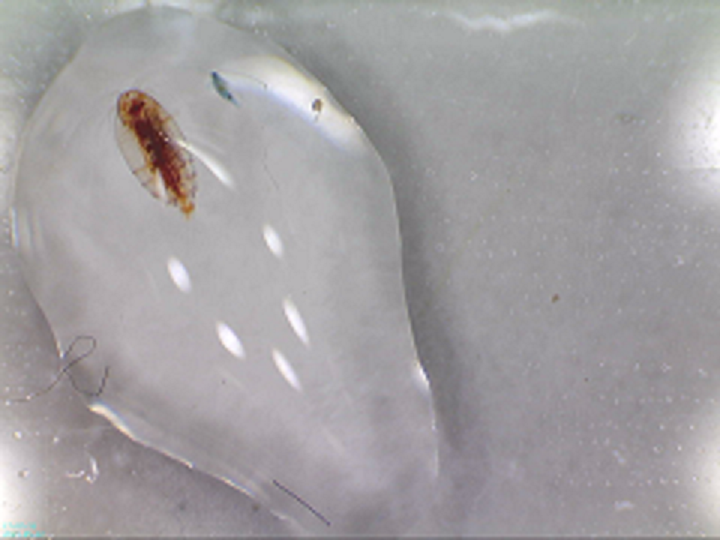
A closeup view of plankton. Photo courtesy of Janis Steele
These changes occurring in the oceans will have profound consequences for the ecology of the whole planet. Here aboard Llyr, we are participating in a citizen science campaign to monitor plankton. We are using two simple tools to do these studies: a Secchi disk and a plankton net.
The Secchi disk is one of the earliest and simplest devices to study plankton in their environment. Because phytoplankton affect the turbidity, or clarity, of the water, an easy visual experiment can tell us a great deal. Invented in 1865 by Pietro Angelo Secchi, the latest version we’re using aboard Llyr is a weighted, white plastic disk attached to a length of rope marked in 50 cm intervals. We lower the disk into the water and the depth at which is disappears is called the Secchi depth. Not only are we recording the turbidity but also the depth to which phytoplankton can grow in the water column. Our data from these experiments in submitted to Plymouth Institute in England, where Dr. Richard Kirby has initiated a campaign to enlist seafarers in monitoring plankton around the world (See Ocean Drifters; A Secret World Beneath the Waves, R. Kirby, Firefly Books 2011).
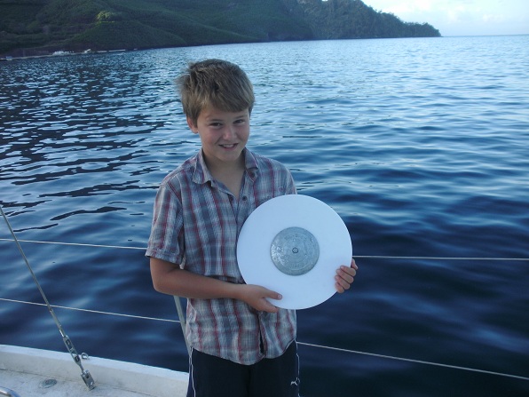
Holding a secchi disk. Photo courtesy of Janis Steele
The second device we are using to study plankton is a plankton net. Charles Darwin used a plankton net during his famous voyage aboard the Beagle. Our 200 micron net is sized for the collection of larger zooplankton. As we tow the net behind Llyr, zooplankton are strained from the water and washed in to the collector at the bottom of the net. We are then able to observe and photograph these creatures using Llyr’s microscope. There are two types of zooplankton: the holozooplankton that spend their whole life cycle as plankton, and the merozooplankton, those creatures that spend just a part of their life cycle as plankton in larval stages, maturing to creatures that live on the sea bed, such as urchins, crabs, worms and mollusks.
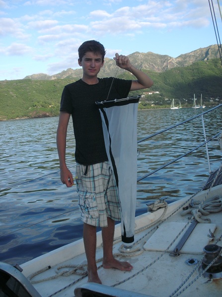
A plankton net. Photo courtesy of Janis Steele.
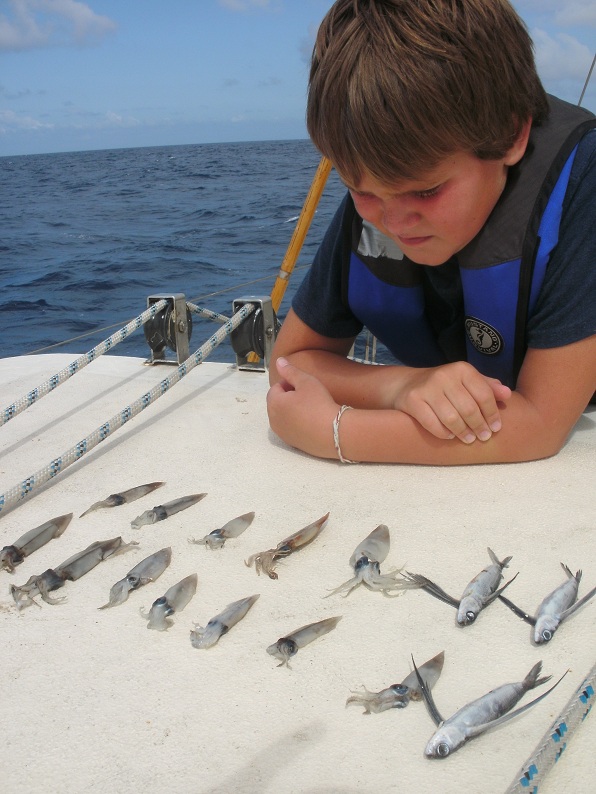
Examining creatures collected from the net. Photo courtesy of Janis Steele.
Today, new and more sophisticated technologies are available to study plankton. It is even possible to observe them from space due to the fact that phytoplankton have photosynthetic and other pigments which color the water when they bloom! Despite the importance of plankton and even though they live on the surface of the sea, there is still much more to learn about plankton, these tiny organisms that make life on Earth possible.
Suggested activity: While these studies are in the ocean, plankton are found in freshwater too. In conjunction with GLOBE hydrology protocols, you can collect water samples to look under a microscope at the types and numbers of plankton. By continuing this experiment over many years, you can begin to learn of the relationship that Steele and McCutchen describe here. If you’ve already examined plankton, we’d love to hear about it! Leave a comment here or on our Facebook page, or send us an email to science@globe.gov.