

Earth System Science Posters



Earth System Science Posters
Earth System Science Poster Cards
Developed by the My NASA Data Team, these digital GLOBE Earth system posters provide images of satellite data to help students observe and analyze earth and environmental data, understand the relationship among different environmental parameters and explore how the data changes seasonally and over longer timescales. The current card deck covers six months throughout 2019, however, members can also find archived posters dating back to 2007.

Earth as a System Learning Activities
Learn how to identify global patterns and connections in environmental data with GLOBE's Earth as a System learning activities. Explore relationships between insolation and surface temperature, aerosols and wildfires, and much more by comparing and contrasting GLOBE poster images. For an example of how to incorporate the Earth System Poster into a curriculum, see the learning activity from the Arctic and Earth SIGNS team.
Learn more about Earth as a System Learning Activities.
Tip: Although the learning activities were originally written for GLOBE's 2007 posters, users can substitute more recent images from the My NASA Data Poster site.

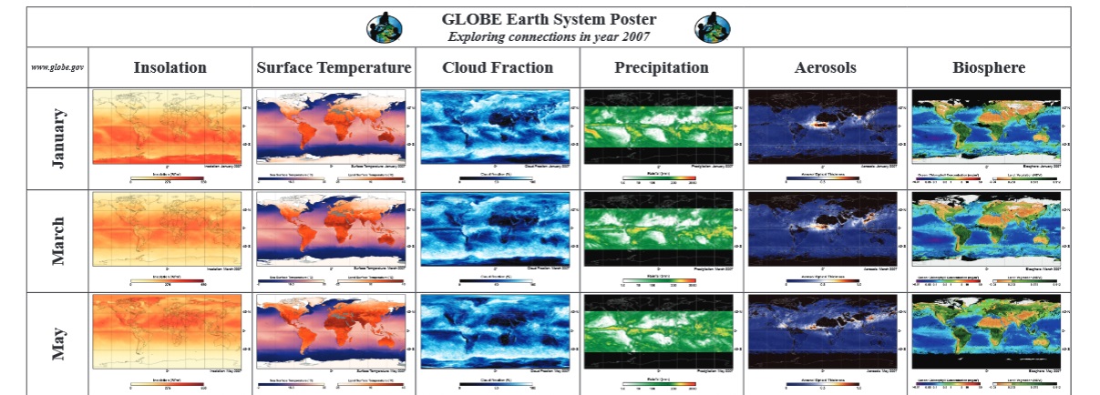
GLOBE Earth System Poster: 2007
View six different 2007 data visualizations side by side with this GLOBE Earth System Poster. Users can download the poster at various sizes or resolutions. Alternatively, you can download individual images from below.
- Small: 340 KB
- Can be printed on 11"x17" paper
- Large: 51.9 MB
- Can be printed on larger cardstock
- Low-resolution: 2.4 MB
- Identical to the "Large" version but with a lower resolution and file size

GLOBE Earth System Poster: 1987
Poster Downloads


Earth System Science Activity Guide: 1987
Downloads
