Published Date4 Years Ago
- 55314 Views
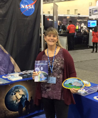
Did you know that NASA satellite data is being used to predict,monitor, and respond to vector-borne and water-related disease around the world? Imagine the value of using both GLOBE ground-based data; such as precipitation, vegetation, soil moisture, surface temperature, and humidity; to help us better understand disease! As you think about what you might like to research for the...
Posted in:
Curriculum:
STEM
Education Research
Science and Math
Technology
Event Topics:
GLOBE Learning Expeditions
Campaigns and Projects (IOPs, etc)
Science Symposia and Fairs
Webinars
Workshops
Competitions
Field Campaigns:
Watersheds
Seasons and Biomes
El Niño
GGIC
SMAP
GPM
GLOBE Science Topics:
Earth System Science
General Science
General Science @es
Climate Change
Data Included
Backyard Science
Climate
Meetings/Conferences
Scientist Skills
Earth as a System
GLOBE Protocols
GLOBE Working Groups:
Evaluation Working Group
Science Working Group
Education Working Group
Technology Working Group
Investigation Areas:
Biosphere
Atmosphere
Earth As a System
Hydrosphere
Pedosphere (Soil)
Learning Activities:
Earth as a System
Atmosphere and Climate
Land Cover/Biology
Hydrology
Soil
News Topics:
Virtual Science Fair
IOPs
SCRC Research
Community Letters
Competitions
Meetings
Primary Audience:
Partners
Scientists
Alumni
Country Coordinators
Trainers
Teachers
Students
Student Research Reports:
U.S. Student Research Symposia (SRS)
International Virtual Science Symposium Report
Standard Research Report
Mission Mosquito Report
Teacher's Guide:
Grade Levels
Document Types
Investigation Area Documents


