SMAP-Old - SMAP
Soil Moisture Active Passive (SMAP) Satellite Mission
NASA's Soil Moisture Active Passive Mission (SMAP) measures soil moisture from space. SMAP has applications in science, agriculture, and environmental management, each of them vital to Earth's health and sustainability. From understanding the processes that link the water, carbon, and energy cycles to improving weather and climate prediction models, SMAP will advance environmental knowledge. The SMAP Spacecraft takes measurements of surface soil moisture and produces daily maps of soil moisture with global coverage every three days. For more details, see SMAP: Applications.
The carbon cycle has more branches than the water cycle. It refers to the transfer of carbon between and among Earth’s atmosphere (air), pedosphere (soil), lithosphere (rock), hydrosphere (surface water: ocean, lakes, and rivers), and the cryosphere (all forms and places where ice is found on Earth including sea ice, snow, glaciers, and permafrost). For example, carbon (in the form carbon dioxide) is found in the air, dissolved in water, and emitted from underground sources as well everything that breathes. Carbonate minerals are found on the sea floor and in mountains, as well as the famous White Cliffs of Dover. Petroleum and coal are carbon that is trapped underground until it is pumped up or mined. All of these forms of carbon can cycle in various ways among the ‘spheres.
Weather and climate studies use SMAP data as well. The amount of water that evaporates from the land surface into the atmosphere depends on the soil moisture. Soil moisture information is key to understanding the flows of water and heat energy between the surface and atmosphere that impact weather and climate. SMAP data acquired since April 2015 has provided ample information about soil moisture variability at either regional or global scales. Frequent and reliable soil moisture measurements from SMAP help improve the predictive capability of weather and climate models.
Students may collect soil moisture data any time and every day and it will be valuable to student researchers. However, choosing dates and times that correspond when the satellite is flying over the site will be the most useful to SMAP scientists.
The final step in the monitoring process is signing onto the GLOBE website and entering the data collected into the GLOBE database. Students and SMAP scientists can visualize the data on the GLOBE website.
BECOME PART OF THE NASA SMAP MISSION WITH THE GLOBE PROGRAM!
Where the land surface is relatively flat, having multiple measurements within a given area can enable calculation of an average value for direct calibration and validation of the satellite data. The SMAP mission has established over 35 SMAP Calibration/Validation (Cal/Val) Partner Sites around the world that are dedicated to collecting soil moisture measurements for this purpose, which will assist the science community at NASA and beyond.
Here is where YOU, as GLOBE schools, can make an especially important contribution:
-
Schools from as many different countries as possible are encouraged to become SMAP Cal/Val Partner schools by joining in clusters of 10 or more schools taking in situ measurements of soil moisture using the GLOBE Soil Protocols. In order to better validate the soil moisture measurements from SMAP, it is important for scientists to have these measurements several times per week and for extended periods throughout the mission. Clusters should all be located within a circle of 20 km in radius to adequately sample SMAP footprint areas. Note: data from schools not within a cluster of 10 schools are also extremely valuable to the SMAP team.
-
Schools within 20 km of a SMAP Cal/Val site offer the added advantage of data comparison with official SMAP scientific ground-truth measurements. These schools would partner with the local Cal/Val site host institution and promptly report their data to GLOBE.
SMAP scientists can use the ground-based GLOBE soil moisture data to compare to the space-based SMAP satellite soil moisture measurements.
As part of the SMAP-GLOBE Program Collaboration, data may be taken following the existing GLOBE soil protocols, but schools are encouraged to follow a modified protocol focusing specifically on taking measurements in a way designed to be most useful for comparison with those of SMAP.
Students from Estonia collecting data using the SMAP Block Pattern Soil Moisture Protocol at the 2015 GRLE in Estonia
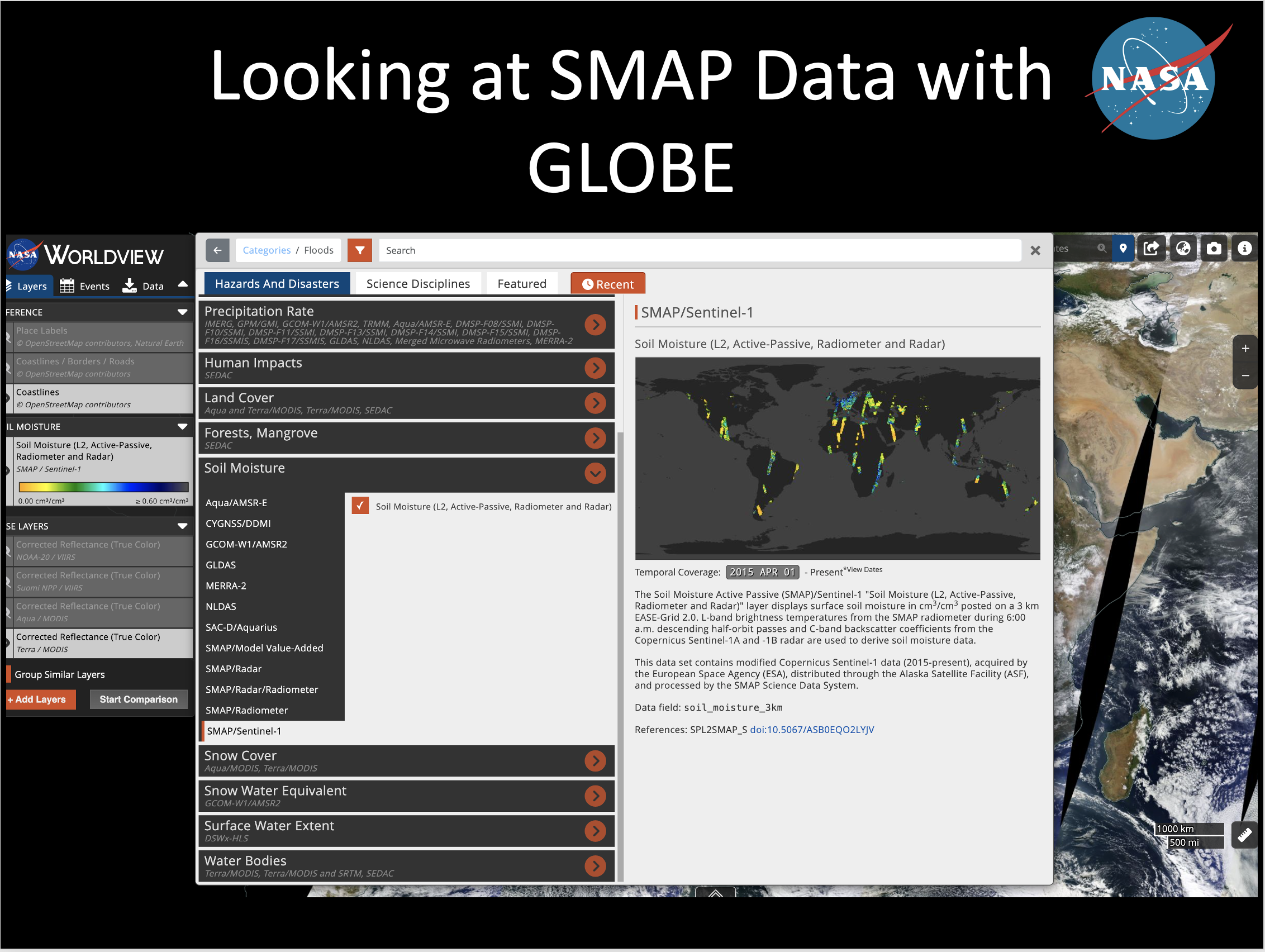
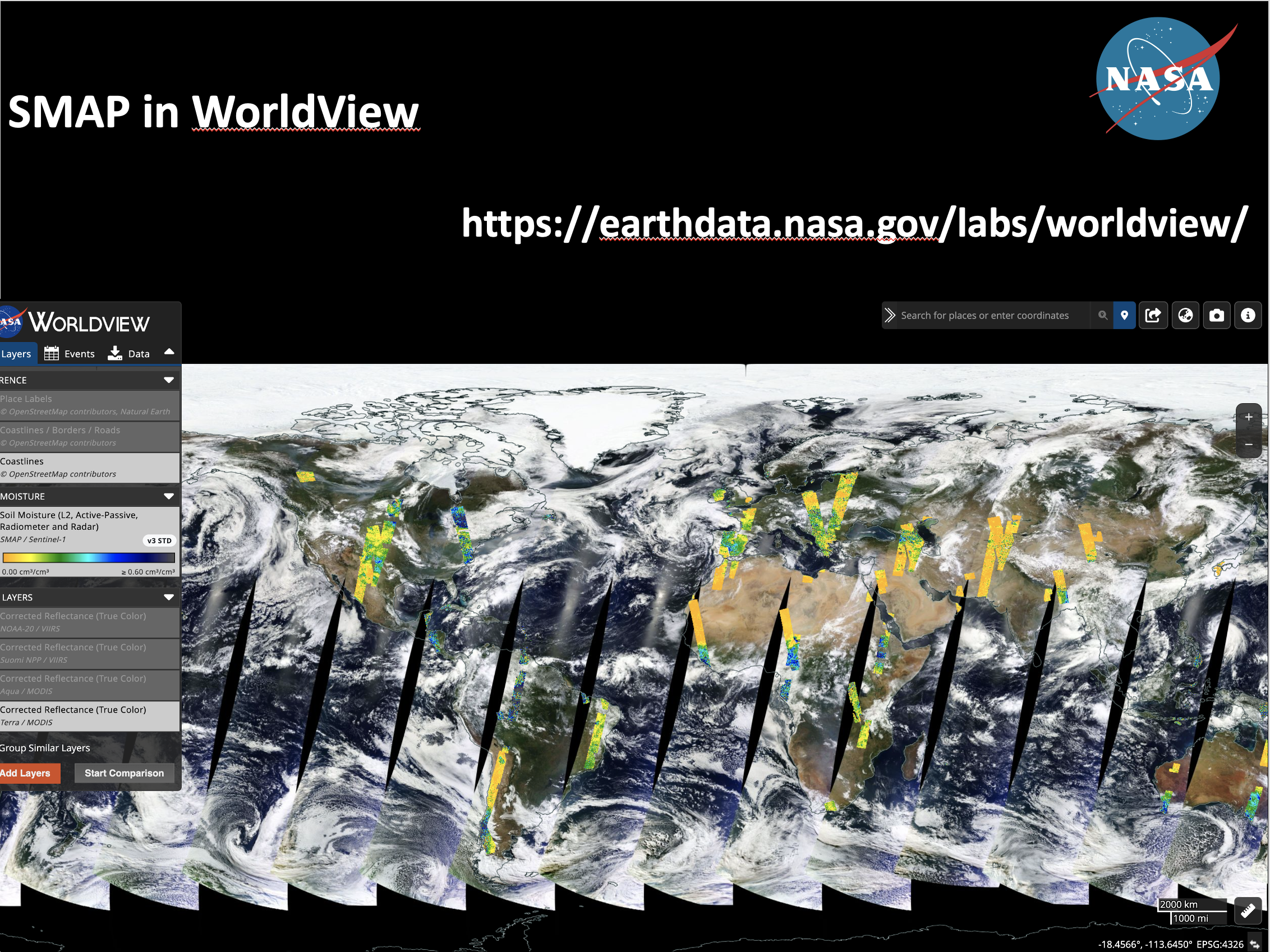
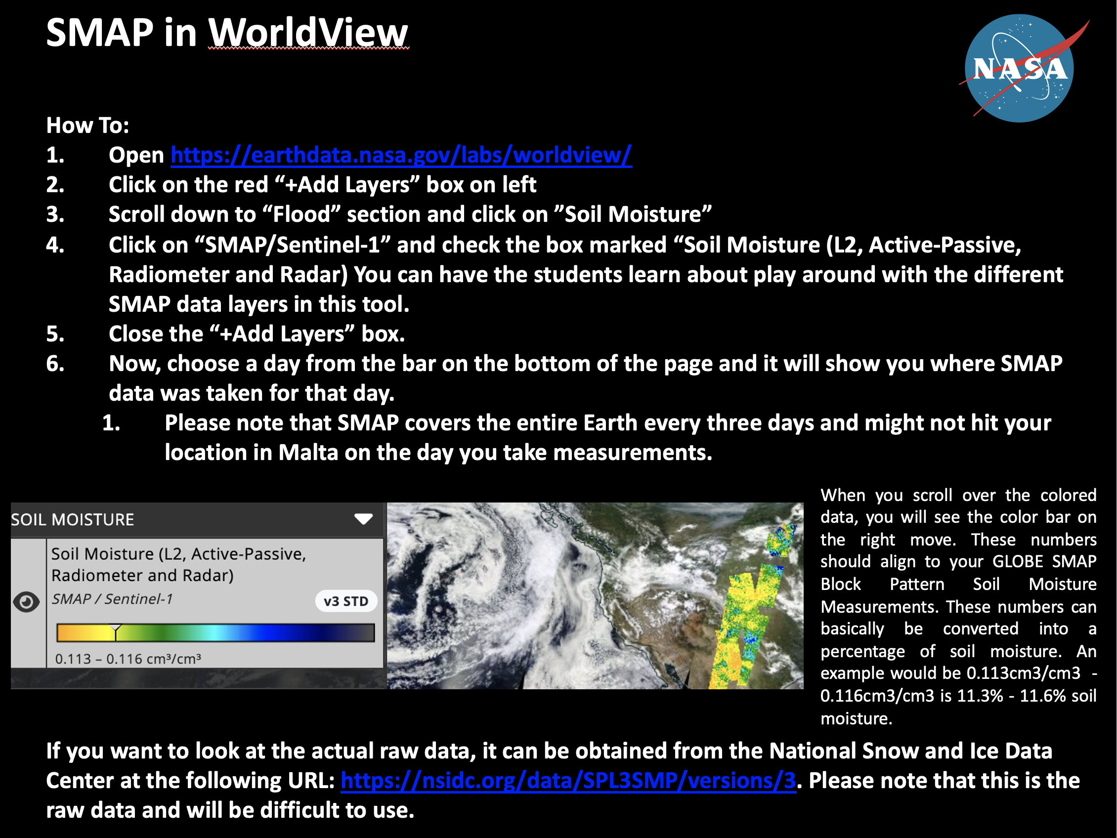
Did you know that you can also view SMAP soil moisture satellite data on the NASA WorldView Online Tool? Check out the series of three images below on how to access the SMAP soil moisture data.


To learn more about the NASA SMAP Mission, visit: http://smap.jpl.nasa.gov.


