Satellite Imagery - Clouds Protocol


Using satellite imagery to study contrails
How do scientists use satellite imagery to study contrails?
Satellite imagery allows scientists to study contrails around
the globe. Satellite imagery is used to determine the rate of growth
and spreading of contrails under different atmospheric conditions.
Scientists can estimate the number of contrails over the Earth from
the pictures, and determine how much cloudiness they add to the
atmosphere. These estimates will help in determining the effect of
contrails on the energy balance of the atmosphere.
What size contrail can be seen from the ground?
Under the right conditions, even the smallest and most
short-lived contrails can be seen from the ground. See the Contrail
Gallery for some examples. This is because the white contrail shows up
very well against the blue sky; and because our eyes have much better
resolution than do satellite instruments. To be fair, we are also much
closer. Typical Earth-observing satellites orbit about 700 km above
the Earth. Contrails occur between 8 and 12 km above the surface (and
us). This is why GLOBE is interested in student observations of contrails.
What size contrail can be seen in a satellite image?
In order to be seen, a contrail must be wide enough (and long
enough) to change the brightness of a satellite pixel. Each pixel
covers a portion of the Earth. The size of that area is determined by
the resolution of the satellite instrument. Typical weather
satellites, such as you see on the news, have pixels that might be 8
km, 4 km, or 1 km on a side. To show up in such an image, a contrail
must be nearly 1 km wide! For Earth science, the state of the art
imager is the MODIS instrument, whose pixels are as small as 0.25 km
on a side. Thus, MODIS can see contrails that are much thinner, around
one quarter kilometer wide.
Can contrails be seen from space? Yes! If contrails
grow large enough, they can be seen from weather satellites orbiting
Earth. The images below (click on image to enlarge) show groups of
persistent contrails over the southeastern US on January 9, 2003.
These pictures show that the number and location of contrails change
rapidly. + View
The Earth Observatory Image Gallery : "The Evolution of a Contrail"
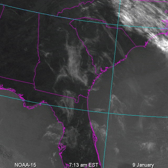
Almost no contrails
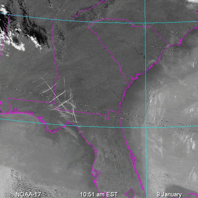
Some contrails over
southeastern Georgia
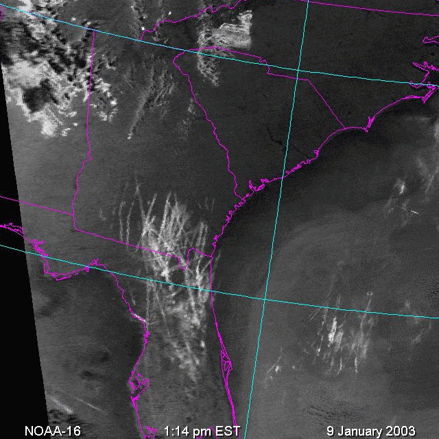
Many Contrails!
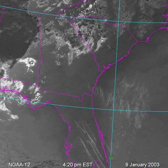
Several contrails over
Florida and nearby ocean