GEO Satellites - Clouds Protocol
Geostationary (GEO) Satellites
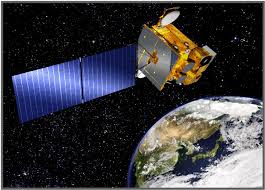
 Geostationary Earth Orbiting (GEO) satellites follow an orbit around the Earth above the Equator at about the same direction and speed of the Earth's rotation. This allows the satellite to remain focused on one area of the Earth's surface at all times. This geostationary positioning is most common with communication and weather satellites so that we do not have to continuously rotate satellite antennas here on Earth to gather the information the satellite is collecting. The (almost) fixed position enhances the ability to monitor sensitive changes in our environment, like weather! Multiple weather GEO satellites work together to monitor the entire globe. The area they observe, called a footprint, covers a majority of the oceans and continents, not capturing the poles. Geostationary Earth Orbiting (GEO) satellites follow an orbit around the Earth above the Equator at about the same direction and speed of the Earth's rotation. This allows the satellite to remain focused on one area of the Earth's surface at all times. This geostationary positioning is most common with communication and weather satellites so that we do not have to continuously rotate satellite antennas here on Earth to gather the information the satellite is collecting. The (almost) fixed position enhances the ability to monitor sensitive changes in our environment, like weather! Multiple weather GEO satellites work together to monitor the entire globe. The area they observe, called a footprint, covers a majority of the oceans and continents, not capturing the poles. |
For matching cloud observations to satellite data we use the following satellites:
GOES–13, USA NOAA
GOES–15, USA NOAA
GOES-16, USA NOAA
HIMAWARI-8, Japan Meteorological Agency
METEOSAT-8, European Organisation for the Exploitation of Meteorological Satellites
METEOSAT-10, European Organisation for the Exploitation of Meteorological Satellites
METEOSAT-11, European Organisation for the Exploitation of Meteorological Satellites
INSAT-3, Indian Space Research Organization
New generations of these satellites are routinely phased in with new technology and instrumentation, providing better spatial resolution and faster coverage for (near) real-time weather data, transmitting images and information as soon as it is collected. Geostationary Weather satellites are a key element of Earth observation as a whole, helping us better understand our planet's weather and climate.


