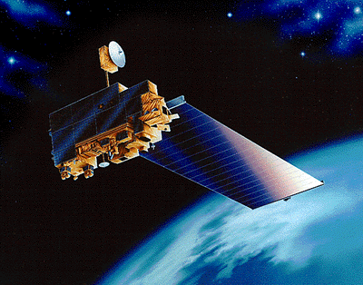
Terra Satellite - Clouds Protocol
Terra (EOS AM-1)

How is Earth changing and what are the consequences for life on
Earth? In December 1999, NASA launched the Terra satellite as the
flagship mission of the Earth Observing System to answer these
questions. The Energy Budget instrument was retired in early 2024
after 25 years of collecting data on the earth.
Terra carries
five instruments that observe Earth’s atmosphere, ocean, land, snow
and ice, and energy budget. Taken together, these observations provide
unique insight into how the Earth system works and how it is changing.
Terra observations reveal humanity’s impact on the planet and provide
crucial data about natural hazards like fire and volcanoes. See Terra science.
Terra is an international mission carrying instruments from the United States, Japan, and Canada. These five instruments are:
- The Advanced Spaceborne Thermal Emission and Reflection Radiometer (ASTER) obtains high-resolution (15 to 90 square meters per pixel) images of the Earth in 14 different wavelengths of the electromagnetic spectrum, ranging from visible to thermal infrared light. Scientists use ASTER data to create detailed maps of land surface temperature, emissivity, reflectance, and elevation.
- There are two identical Clouds and Earth’s Radiant Energy System (CERES) instruments aboard Terra that measure the Earth’s total radiation budget and provide cloud property estimates that enable scientists to assess clouds’ roles in radiative fluxes from the surface to the top of the atmosphere. One CERES instrument operates in a cross-track scan mode and the other in a biaxial scan mode. The cross-track mode essentially continues the measurements of the Earth Radiation Budget Experiment (ERBE) and the Tropical Rainfall Measuring Mission (TRMM), while the biaxial scan mode provides new angular flux information that has improved the accuracy of angular models used to derive the Earth’s radiation balance.
- The Multi-Angle Imaging SpectroRadiometer (MISR) is a new type of instrument designed to address this need — it views the Earth with cameras pointed at nine different angles. One camera points toward nadir, and the others provide forward and aftward view angles, at the Earth’s surface, of 26.1°, 45.6°, 60.0°, and 70.5°. As the instrument flies overhead, each region of the Earth’s surface is successively imaged by all nine cameras in each of four wavelengths (blue, green, red, and near-infrared).
- With its sweeping 2,330-km-wide viewing swath, the Moderate Resolution Imaging Spectroradiometer (MODIS) sees every point on our world every 1-2 days in 36 discrete spectral bands. Consequently, MODIS tracks a wider array of the earth’s vital signs than any other Terra sensor. For instance, the sensor measures the percent of the planet’s surface that is covered by clouds almost every day. This wide spatial coverage enables MODIS, together with MISR and CERES, to help scientists determine the impact of clouds and aerosols on the Earth’s energy budget.
- Measurement of Pollution in the Troposphere (MOPITT) is an instrument designed to enhance our knowledge of the lower atmosphere and to observe how it interacts with the land and ocean biospheres. MOPITT’s specific focus is on the distribution, transport, sources, and sinks of carbon monoxide in the troposphere. Carbon monoxide, which is expelled from factories, cars, and forest fires, hinders the atmosphere’s natural ability to rid itself of harmful pollutants.


