Cloud Type - Clouds Protocol


Cloud Type
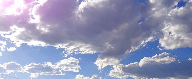
The type of clouds you see in the sky can provide us with valuable information about their interactions with the surrounding atmosphere. Specific clouds are defined by their shape, the cloud base altitude, and whether they are producing precipitation. Scientists use these observations to verify their satellite measurements and draw conclusions about the climate in particular areas.
When you're observing the clouds above you, remember to look in every direction and take note of each cloud’s base level, whether it's low, middle, or high in the sky. Then, you can use the GLOBE Cloud Chart, the interactive dichotomous key, and the "Shape-Height" definitions found in Observing Cloud Type Guide to further classify the cloud.
Learn more about observing Cloud and Contrail types
Tip: Cloud Type observations are a qualitative measurement, so the labels we've constructed for them don't always align with how they appear in the sky.
Identify and Classify Clouds
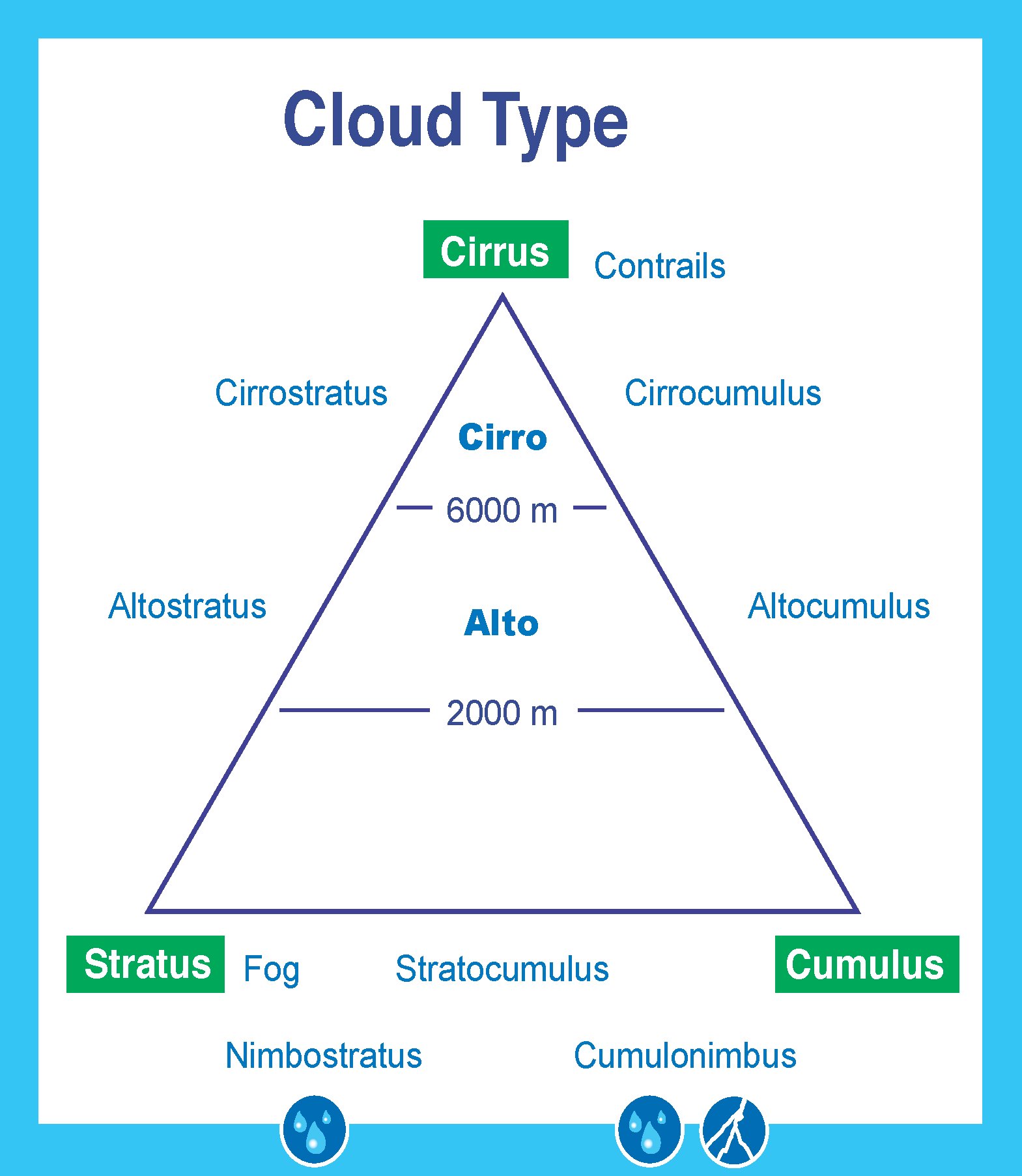
Clouds are identified in twelve type-classes. The names we use for a particular cloud are based on three factors:
- Shape
- Altitude of formation
- Precipitation production
Shape
Clouds come in three basic shapes:
- Cumulus: Heaped and puffy
- Stratus: Layered
- Cirrus: Wispy
Altitude of Formation
When we measure a cloud's altitude, we note it by the position of the cloud base. Clouds occur in three main altitude ranges:
- Low: Cloud base < 2,000m, no designated prefix
- Stratus
- Nimbostratus
- Cumulus
- Stratocumulus
- Cumulonimbus
- Fog (an extremely low cloud that touches the ground)
- Middle: Cloud base between 2,000 - 6,000m, designated by the prefix "alto-"
- Altocumulus
- Altostratus
- High: Cloud base > 6,000m, "cirrus" clouds or designated by the prefix or "cirro-"
- Cirrus
- Cirrocumulus
- Cirrostratus
Precipitation Production
When clouds are actively producing precipitation, we affix the word "nimbus" into the cloud's name, or we designate it by the prefix "nimbo-". For example, "cumulonimbus" and "nimbostratus" are two cloud types that denote actively falling precipitation.
Note: While both cumulus and cumulonimbus clouds may have their bases starting below 2,000m, they often grow tall enough to extend into the middle or even high atmospheric levels. Because of this, scientists often refer to them as "clouds of vertical development." When these formations are viewed from satellites, they're generally classified as mid- or high-level clouds.
Contrails
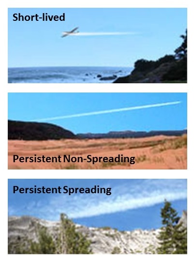
Contrails are thin, long clouds that form around the small particles, or aerosols, left behind in the exhaust of passing aircraft. If these trails persist, then they too become clouds and are of scientific importance. Under the right conditions, these trails can spread to cover the whole sky.
Make sure you specifically flag the presence of contrails in your observations and whether they are short-lived, persistent non-spreading or persistent spreading.