ICESat-2 Mission - Trees around the GLOBE


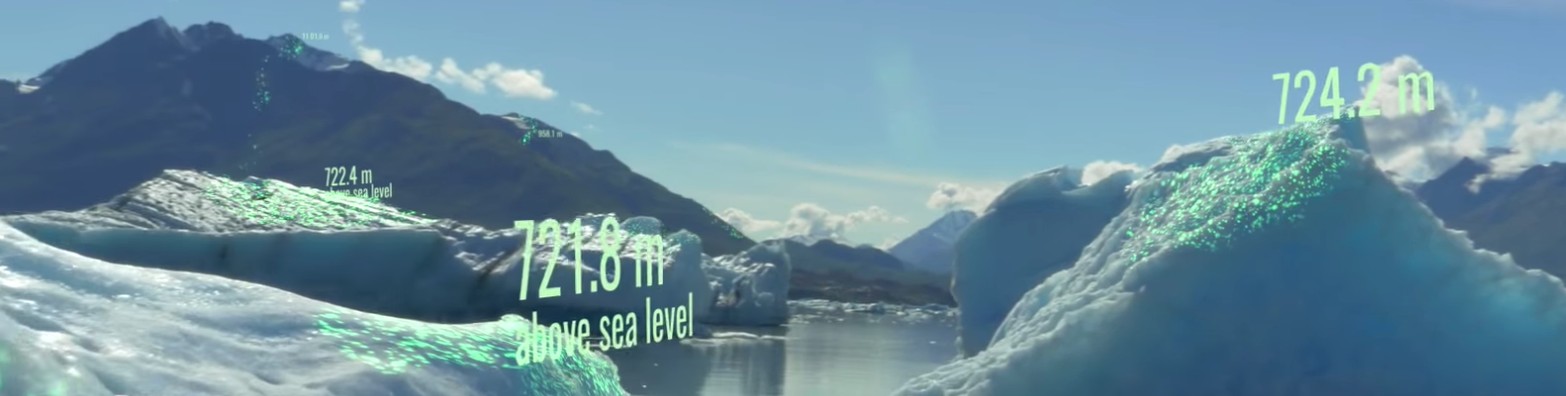
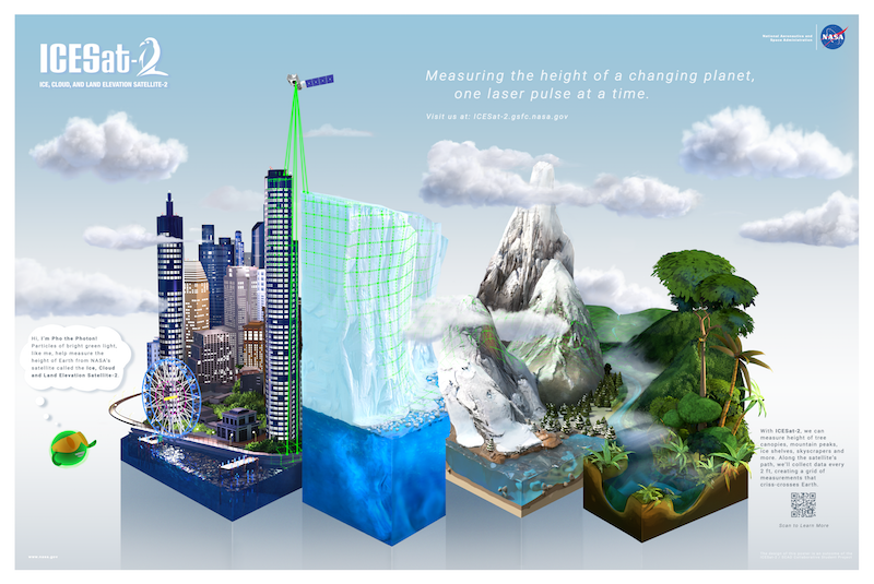
ICESat-2 Mission
Learn more about the ICESat-2 Satellite.
ICESat-2 and GLOBE
Students can compare GLOBE Observer and their own ground-based tree height data, with the space-based ICESat-2 satellite data. This data can then be used in student research projects for Student Research Symposia and the IVSS.
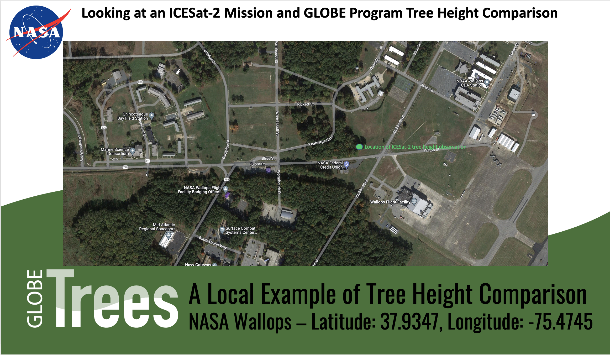
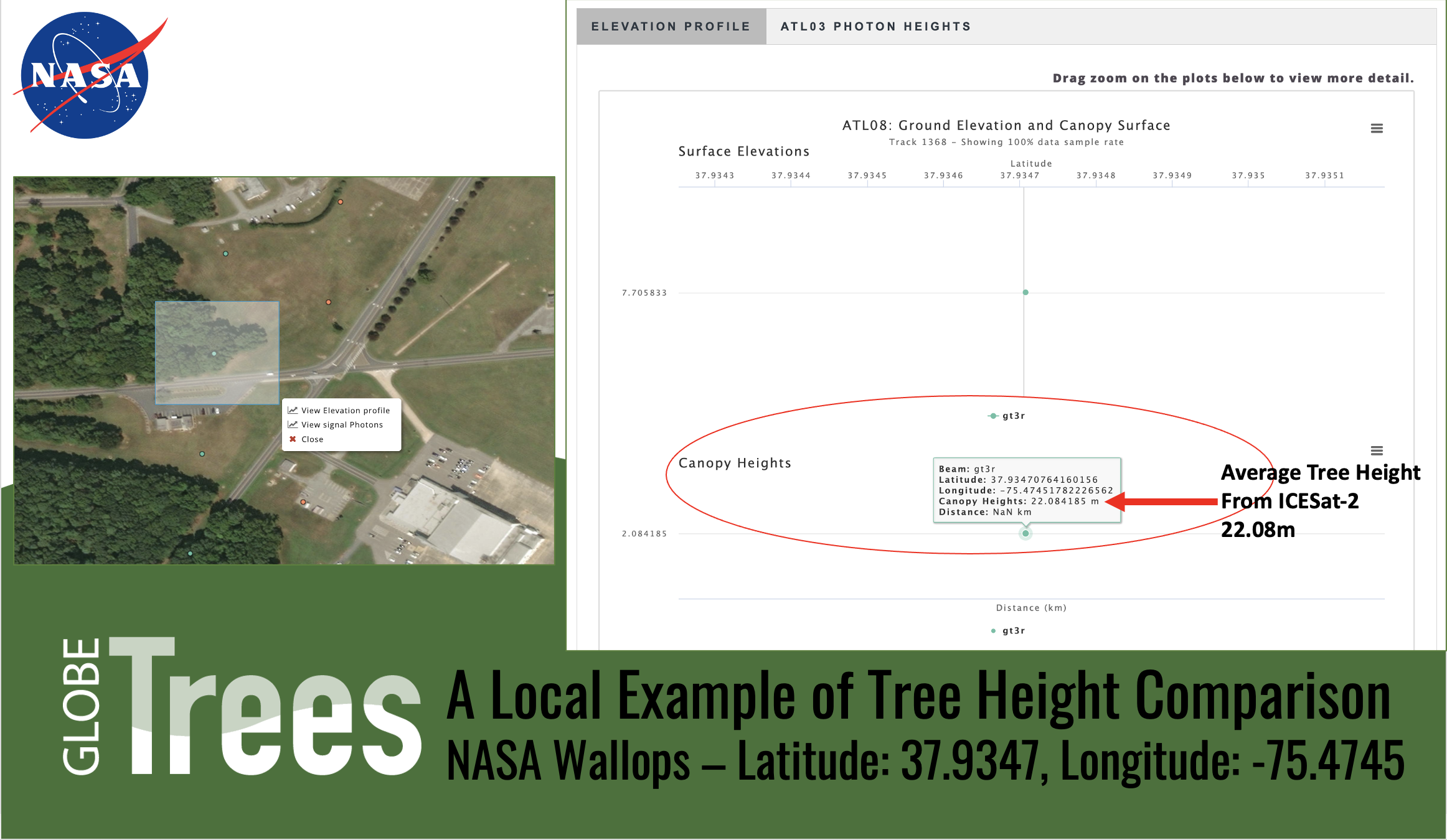
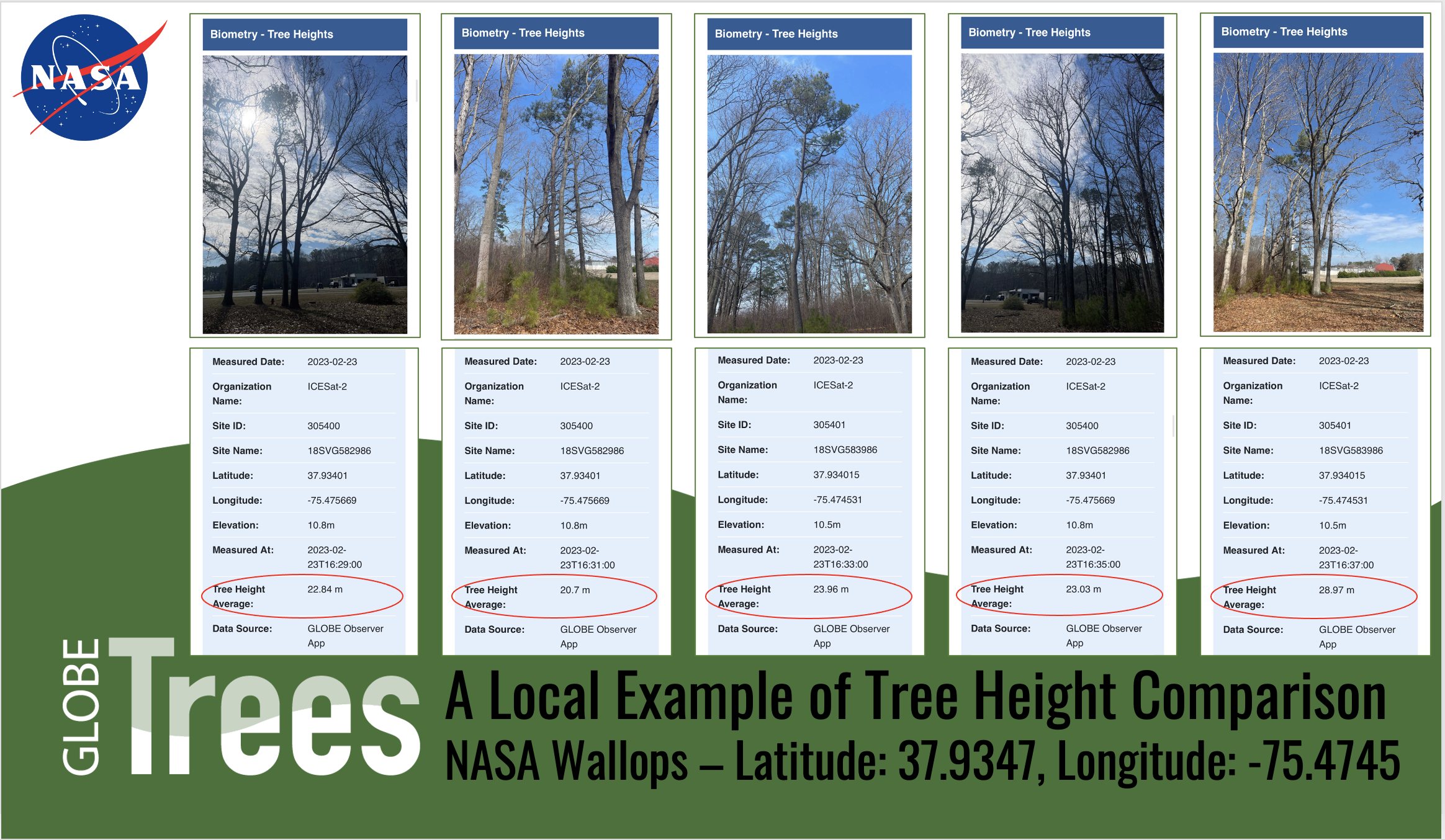
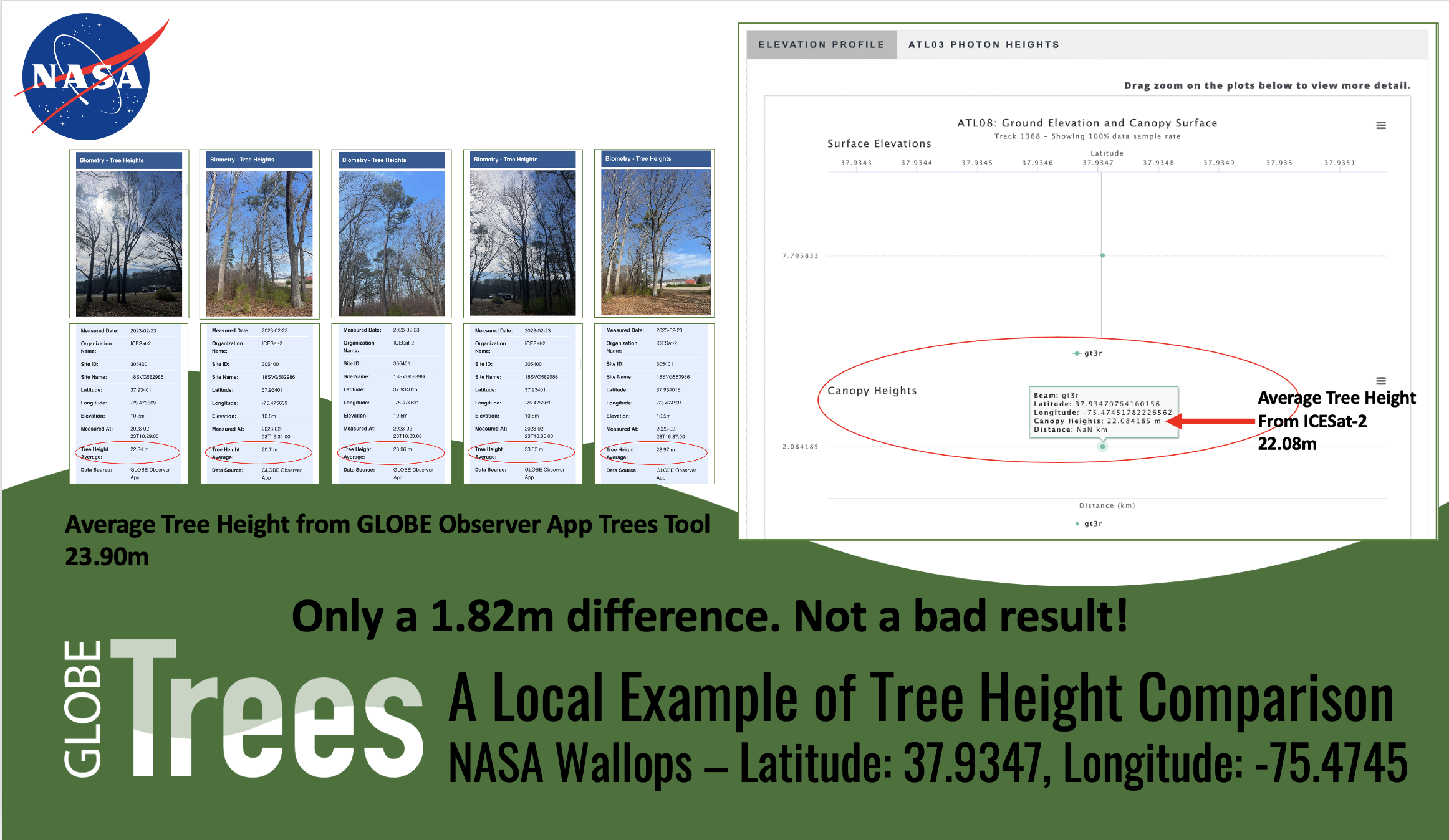
Ground-based tree height data can be compared to the space-based tree height data from the NASA ICESat-2 Mission. Tree height observations from GLOBE represent a single tree, whereas laser photons from the ICESat-2 Mission measure many trees. Individuals that take GLOBE measurements of multiple trees in a single stand area are more closely mimicking the data scientists use from ICESat-2.
Satellite Data Comparisons
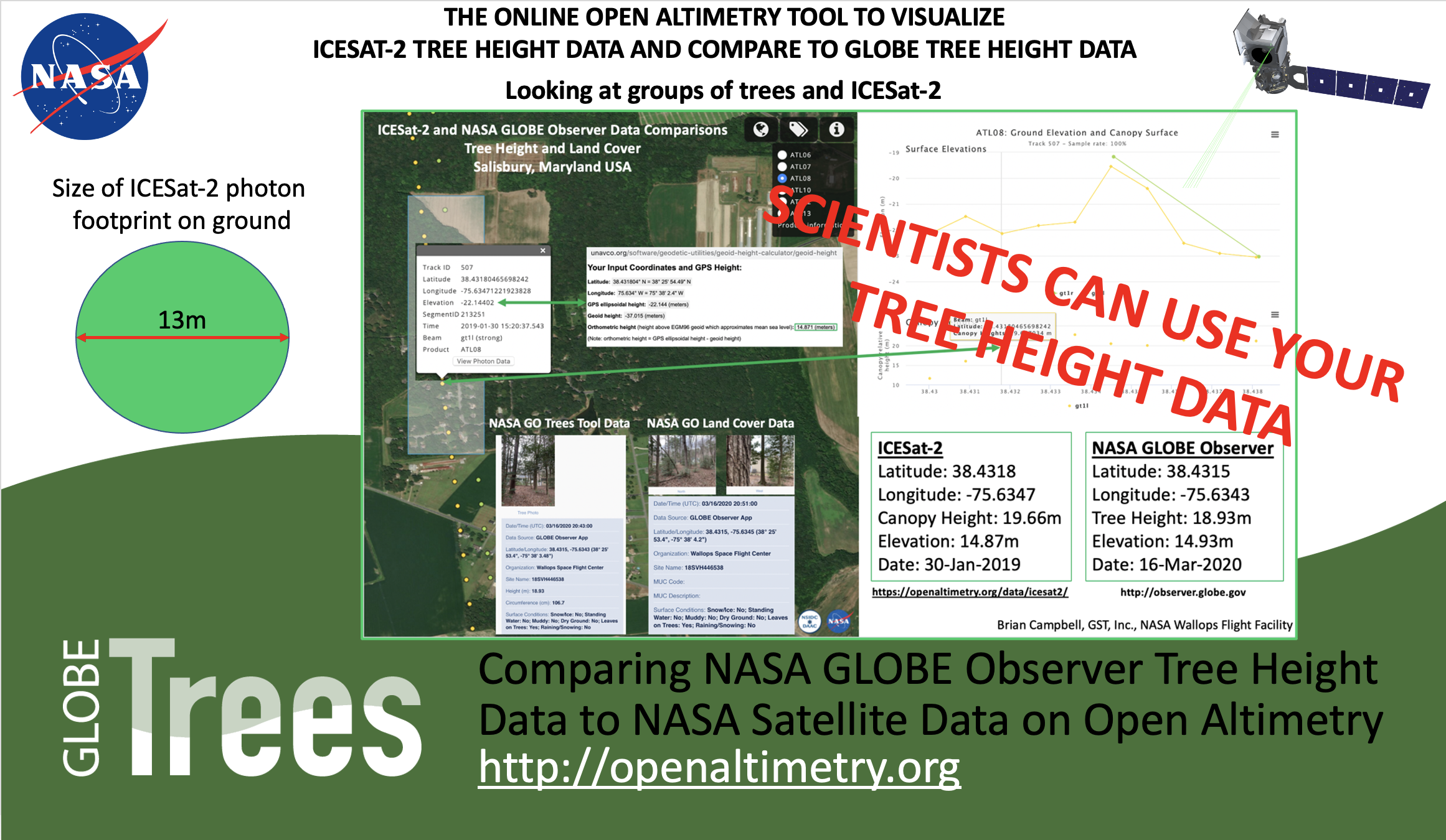
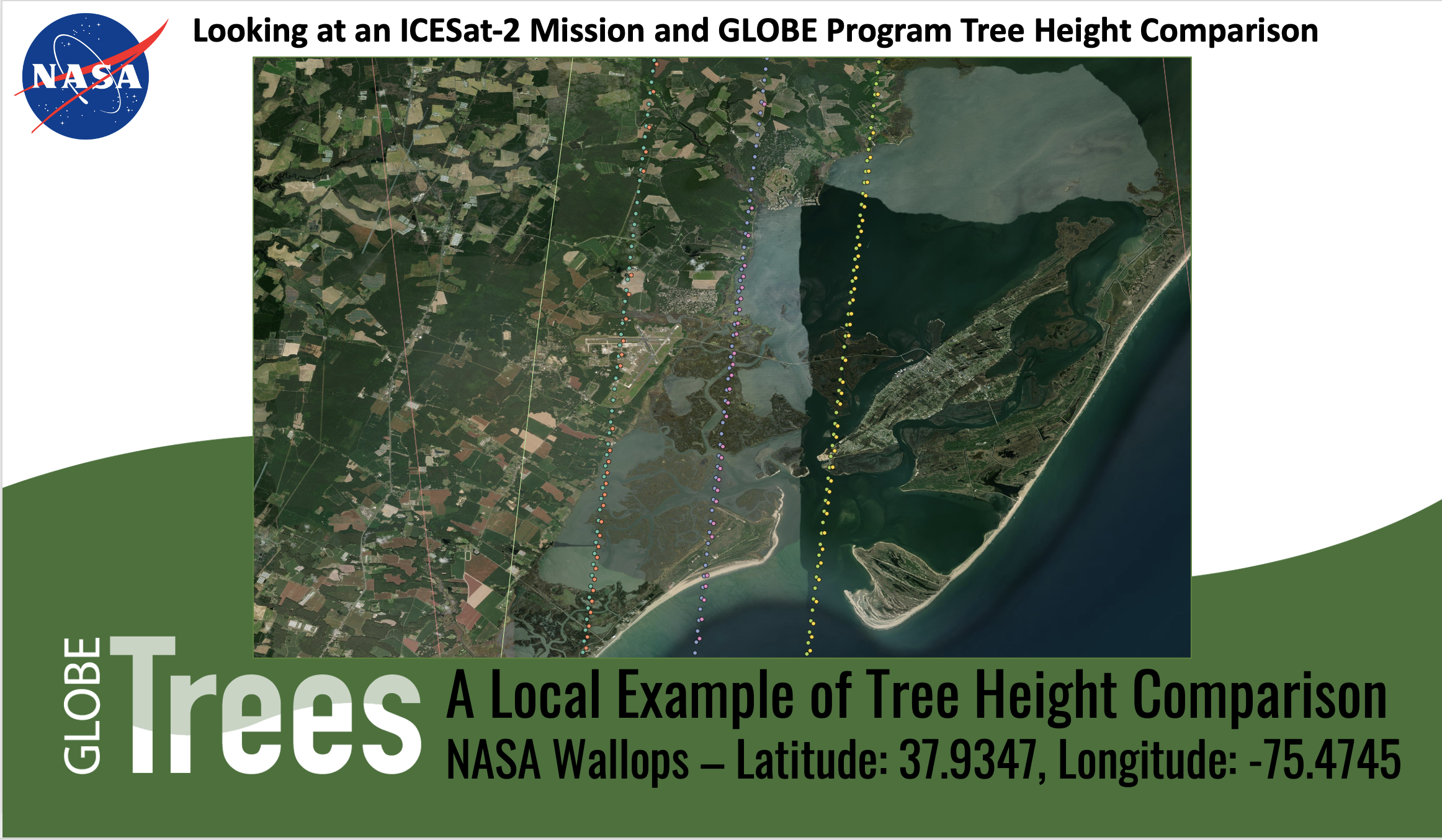
GLOBE and Open Altimetry
As part of the Trees Around the GLOBE Student Research Campaign, the GLOBE team wants to showcase an online tool that can assist in data analysis, data visualization and imagery analysis. Learn more about NASA's Open Altimetry tool below:
- ICESat-2 Data on Open Altimetry
- OpenAltimetry is a cyberinfrastructure platform for discovery, access and visualization of data from NASA’s ICESat and ICESat-2 missions. These laser profiling altimeters are used to measure changes in the topography of Earth’s ice sheets, vegetation canopy structure, clouds and aerosols. A new paradigm for data access was required to serve the needs of a diverse scientific community seeking to take advantage of these unique observations. OpenAltimetry, which is the product of a collaboration between the National Snow and Ice Data Center (NSIDC), the Scripps Institution of Oceanography and San Diego Supercomputer Center at UC San Diego, was custom-built to meet these needs.